New USACE Tools Improve Wetland Delineation Accuracy and Efficiency

Home / Articles / External Government

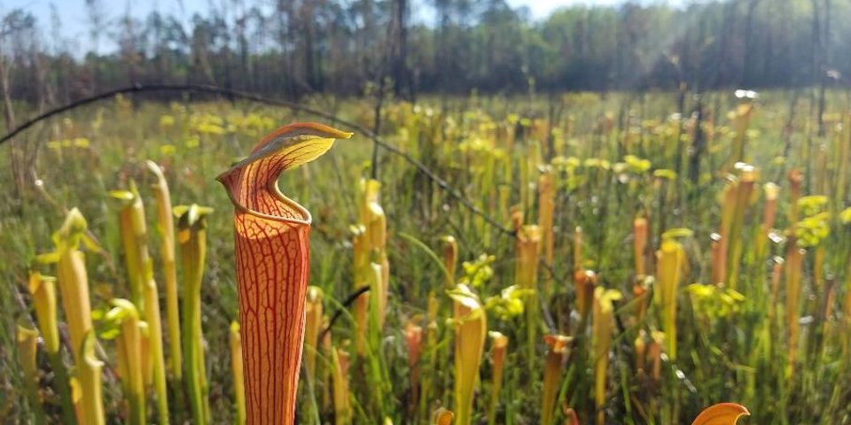
Hydrophytic vegetation, or wetland vegetation, are those communities of plants occurring in areas that are inundated or saturated long enough to influence the plants’ occurrence. Hydrophytic vegetation is one of three factors addressed using the Automated Wetland Determination Data Sheets during the collection and analysis of wetland delineations across the nation (U.S. Army Corps of Engineers photo).

May 9, 2022 | Originally published by U.S. Army Corps of Engineers on April 25, 2022

VICKSBURG, Miss. – Scientists with the U.S. Army Engineer Research and Development Center’s Environmental Laboratory (ERDC-EL) and U.S. Army Corps of Engineers (USACE) Detroit District’s Regulatory staff are streamlining wetland delineation by developing automated wetland determination data sheets (ADS).

The ADS streamline wetland delineation data collection and reporting, facilitating responsible natural resource management and providing a valuable tool for the public.

The USACE Regulatory Program is committed to protecting the nation’s aquatic resources and navigation capacity while allowing reasonable development through fair and balanced decision-making. Under Section 404 of the Clean Water Act, USACE is responsible for evaluating dredged or fill material discharge into U.S. waters, including wetlands.

Want to find out more about this topic?

Request a FREE Technical Inquiry!